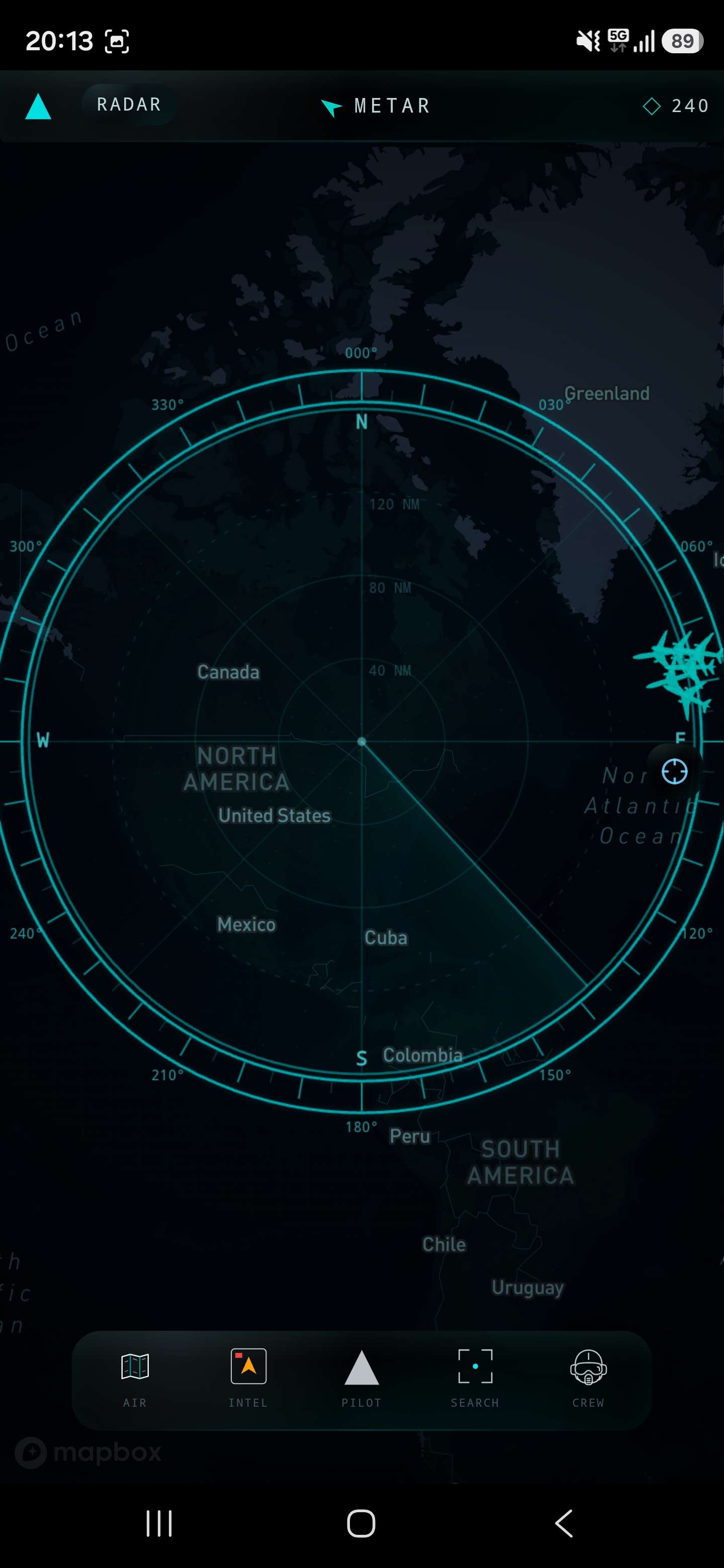
Live Aircraft Tracking
Monitor aircraft positions, altitude, groundspeed, headings, callsigns and registration details in a focused operational view.
Fly Away Today Ltd presents
Aviation Situational Awareness Platform
NiteOcean is a professional aviation software product for monitoring live aircraft, interpreting airspace activity and bringing route, weather and operational context into a single mobile-first interface.
Active Development
NiteOcean is currently in active development and preparing for public release on iOS and Android. The product preview below uses real application screenshots from the current development build.
Product
NiteOcean brings live traffic, aircraft detail, airport context and aviation weather into a clear HUD-inspired interface designed for fast scanning and informed decisions.
Product Preview
These screenshots show the current mobile interface direction for airspace monitoring, aircraft detail, route context and aviation weather workflows.
Features
Monitor aircraft positions, altitude, groundspeed, headings, callsigns and registration details in a focused operational view.
Turn raw traffic signals into actionable airspace context with aircraft categorisation, selection tools and tactical situational cues.
Review route and airport context around observed traffic so operators can understand likely movement patterns and flight intent.
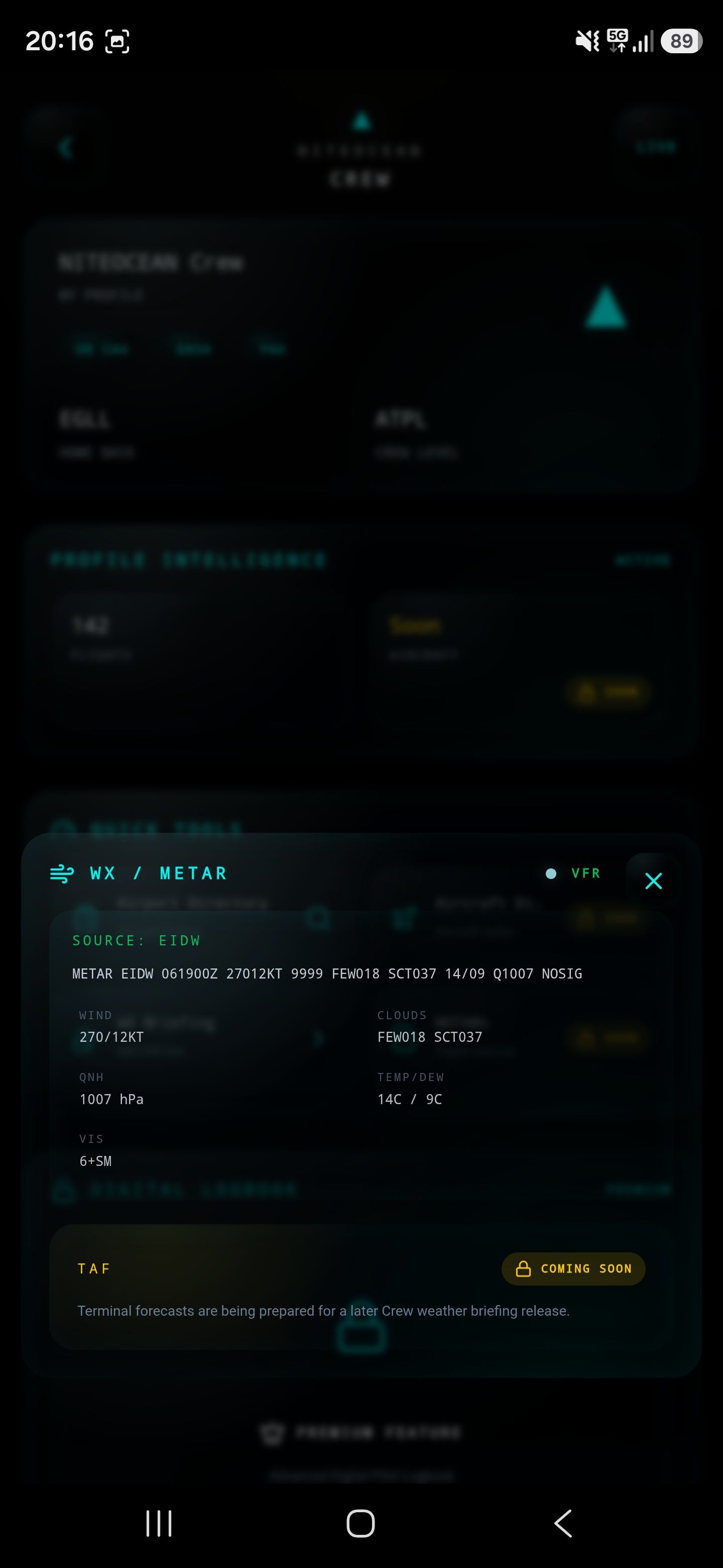
Surface aviation weather context, including METAR-oriented airport weather workflows, alongside aircraft and airspace information.
Built for quick, readable access on mobile devices while retaining the clarity required for desktop airspace monitoring.
Platform Availability
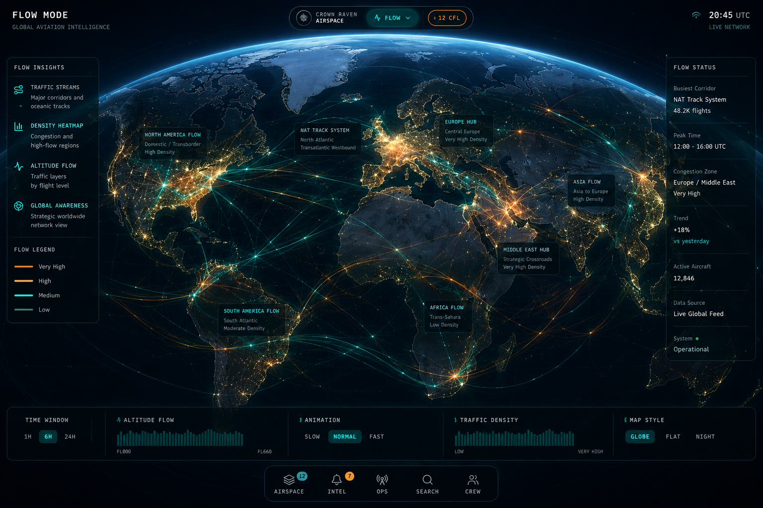
Global Aviation Intelligence
NiteOcean is being built around a broader vision of clear, global aviation intelligence: traffic density, route movement, weather-aware decision support and mobile-first situational awareness for aviation users.
Image shown as a vision concept for global aviation intelligence, not as a claim of current production functionality.
About
NiteOcean is developed and operated by Fly Away Today Ltd, a UK registered company. The platform is built as a genuine aviation software product for airspace monitoring, aircraft intelligence and aviation situational awareness.